Heyward cove stormwater master plan
Bluffton, SC
Client: Town of Bluffton
Date Completed:
Professional Services: June 2023
Construction: N/A
Services Provided:
Stormwater modeling and design
2D Modeling
Developing capital improvement projects with prioritization
Asset inventory assessment
Tidal gaging
Resiliency design
Inundation mapping
QA/QC Reviews
Flood Risk Mapping
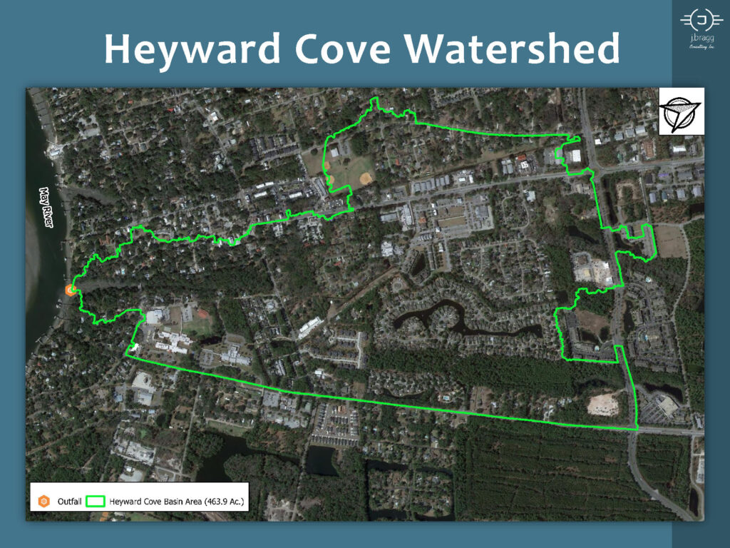
DESCRIPTION: Heyward Cove Master Plan was a comprehensive conceptual level stormwater infrastructure project focused on a tidally influenced 464-acre basin located in the Town of Bluffton, South Carolina. The project’s primary objective was to develop a master plan and recommend Capital Improvement Projects (CIP) that would elevate the stormwater systems’ level of service to meet the Town’s stormwater standards. J. Bragg Consulting, Inc. was contracted by the Town to perform a stormwater system inventory, condition assessment, conduct existing and proposed conditions Hydrologic and Hydraulic (H & H) analysis, and prepare recommendations and propose CIP for stormwater management systems that were assessed with structural issues, maintenance related issues and systems that did not meet the Town’s capacity standards.
The H & H analysis of the Heyward Cove Master Plan project included the development of a 2-D SWMM stormwater model of the existing conditions starting with the asset inventory in GIS format. The inventory was delivered as a geodatabase which was compatible with the Town’s GIS schema and a geometric network was developed so that the information was easily imported into the SWMM model. The model was used to identify choke points, flood prone areas, pipes and channels which did not meet capacity standards. This information, along with the system conditions assessment was then used to prioritize stormwater CIP projects, complete with cost estimates. The project deliverables included existing and proposed improvement inundation maps, flood depth risk maps, and inundation mapping for resiliency conditions, which considered sea level rise and projected higher intensity rainfall data for the next 70 years. Tidal gaging was also conducted for the project in order to fully understand the tidal fluctuations of the May River and provide real world tidal outfall boundary conditions for both existing and proposed conditions.
CHALLENGES: Challenges faced during the project included reviewing flood improvement project designs from the 1970s as a baseline comparison for project improvements and translating GIS field data into an accurate 2D stormwater model. The GIS translation was resolved by developing the geodatabase into a geometric network. Challenges also included model data storage management and data sharing due to the large file sizes associated with multiple 2D model stormwater models.
RESPONSIBILITIES: The engineer’s responsibilities encompassed managing the gathered field data for the asset inventory, utilizing the asset inventory to create GIS mapped maintenance plans, setting up and gathering tidal data from a gauge on the May River at the basin’s confluence, and developing 2D modeling scenarios. Engineers also performed model calibration using real weather precipitation and water level monitoring data from a town-owned monitoring station within the basin. Other responsibilities included basin hydrology development for the subbasins, hydraulic improvement design, and report development. The project also entailed evaluating the stormwater inventory ownership and stormwater level of service in relation to the proposed stormwater improvements.
18 Daffodil Farm Way
Bluffton, SC 29910
Copyright 2020 J Bragg Consulting, Inc.
All Rights Reserved